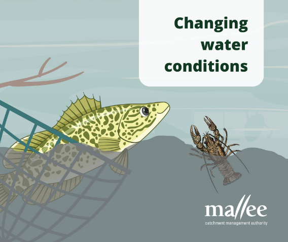
With the weather warming up in the Mallee region over the next few days, we’re expecting the low levels of dissolved oxygen (blackwater) in Murray river, creeks and wetlands to get worse. Low dissolved oxygen makes it hard for fish and Murray crays to survive.
Over the past few weeks, authorities in Victoria and NSW have been working hard to save as many native fish and crays as possible, including threatened species.
There are procedures in place for government agencies including the Mallee CMA to work together on managing fish death events, including co-ordination with NSW for the Murray River.
To report any instances of stressed or stranded fish in the Mallee please Email fish@malleecma.com.au
Fish deaths:
Contact Environmental Protection Authority Victoria (EPA) on
1300 372 842 or Email contact@epa.vic.gov.au.
The Mallee CMA is not the lead agency to contact during a flood event. You can find further information regarding current conditions from:
BoM website – Wimmera Mallee Rainfall and River Conditions
The Victoria State Emergency Service (VICSES) has developed a multicultural Robinvale Flood Guide translated into six different languages. Further information and these guides can be provided at the VICSES website.
Flood impacts – grants and support are available for community and businesses impacted by the floods.
A floodplain is the area of land that is inundated when a waterway can no longer contain the catchment’s run-off within its beds and banks.
Floodplains play an important role in the temporary storage of floodwaters and often have significant environmental values. The main aims of floodplain management are to protect:
The Mallee CMA is responsible for a range of statutory functions under the following state government acts, relating to floodplain management:
Victorian Water Act 1989, Victorian Planning and Environment Act 1987 and Victorian Building Regulations 2006
Key functions include:
Further information on these functions is provided below, and also on the Flood Victoria website
The Mallee CMA is not the lead agency to contact during a flood event. The Mallee CMA is responsible for floodplain management in the Mallee region. Our role is to give advice that encourages appropriate development and reduces the impacts of flooding on life, property and infrastructure.
The Mallee CMA can provide the following information:
If you would like flood advice on a specific property, please click on this link, complete the form and submit to floodplain@malleecma.com.au.
For information on your property and the relevant flood zoning visit the VicPlan website: VicPlan (planning.vic.gov.au)
The Mallee CMA has statutory responsibilities under the Water Act 1989 and ‘By-law No.1 Waterways Protection 2014’ to monitor, manage, enforce, and administer control over works which may impact upon designated waterways throughout the Mallee region to ensure works undertaken do not adversely affect the health of those waterways. The approval process is designed to provide best-practice guidance to ensure works or activities have appropriately addressed hydraulic, physical, and environmental impacts on the health of our waterways. For any water supply queries/issues, please contact your local Water Authority.
All works and activities within the bed and banks of designated waterways in the Mallee region require an approved Works on Waterways Permit from Mallee CMA. A designated waterway is a waterway that is named or un-named, permanent or seasonal, and may range in size from a river to a natural depression. Designated waterways are declared under the Water Act 1989 to protect their environmental values. Click here to view Designated Waterways within the Mallee CMA region.
A works on waterways permit is required for a range of works, including:
If your proposed work, is not listed here, please contact the Mallee CMA to check if it requires a permit.
Note: penalties apply if you do works on a waterway without a permit.
Download a Works on Waterways Permit Application or request a paper copy direct from Mallee CMA.
Complete the application form and submit to the Mallee CMA in person, by mail or email: floodplain@malleecma.com.au.
The Mallee CMA does not currently charge a fee to undertake the Works on Waterways Permit process.
Chapter 17 of the Victorian Floodplain Management Strategy 2016 sets out a series of policies, accountabilities and actions
for levees and other forms of flood mitigation infrastructure. Collectively, they define the Management Framework for Flood mitigation Infrastructure in Victoria.
The Department of Environment, Land, Water and Planning has released a series of Guidance Notes aimed at helping those wishing to construct
or maintain infrastructure. This includes:
To find out more information click here.
Mallee Catchment Management Authority
Cnr Koorlong Avenue and Eleventh Street
Irymple VIC 3498
P 03 5001 8600
The Mallee Catchment Management Authority (CMA) acknowledges and respects Traditional Owners, Aboriginal communities and organisations. We recognise the diversity of their cultures and the deep connections they have with Victoria’s lands and waters. We value partnerships with them for the health of people and country. The Mallee CMA Board, management and staff pay their respects to Elders past and present, and recognise the primacy of Traditional Owners’ obligations, rights and responsibilities to use and care for their traditional lands and waters.

© 2020 All rights Reserved.